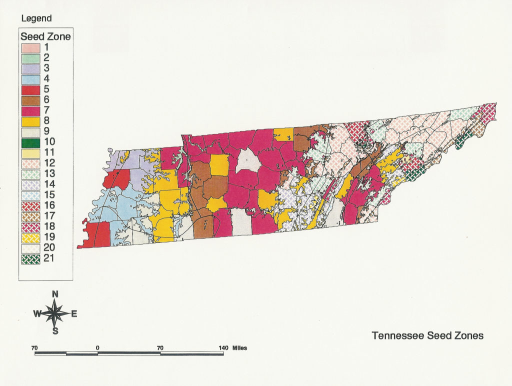
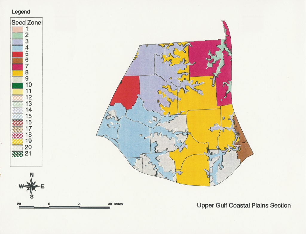
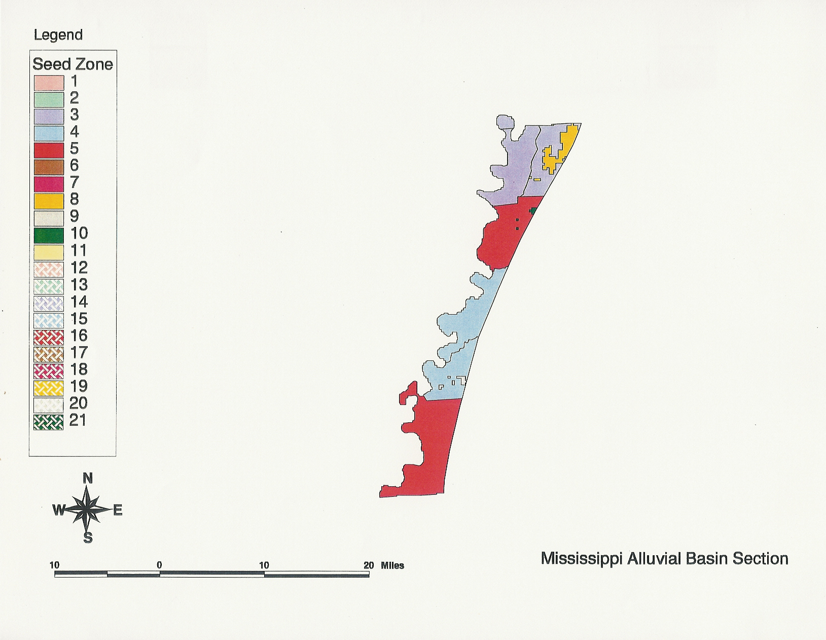
The Tennessee Seed Zone System was developed to guide seed collection for reforestation and research across the state of Tennessee, including statewide zones, ecoregions, and individual counties. The seed zone maps were created using 30 years of county-level weather data, elevation gradients, and information from Bailey’s Ecoregions (Bailey, R.G. 1980. Description of the Ecoregions of the United States. USDA Forest Service Misc. Publ. 1391).
For a more detailed description of the development process, see: Post, Lisa S., S.E. Schlarbaum, Frank van Manen, R.A. Cecich, A.M. Saxton, and J.F. Schneider. 2003. Development of Hardwood Seed Zones for Tennessee Using a Geographic Information System. Southern Journal of Applied Forestry 27(3): 172–175.
If you would like a specific seed zone map or the complete set of maps, please contact us and we will provide the appropriate image. You can email us at amains@utk.edu for your request.
Samples of state and ecoregion level seed zone maps.
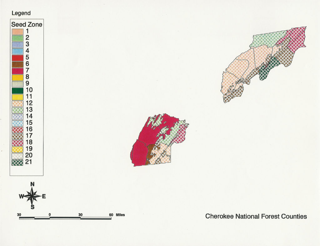
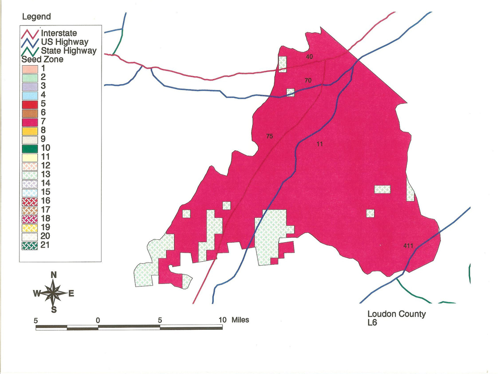
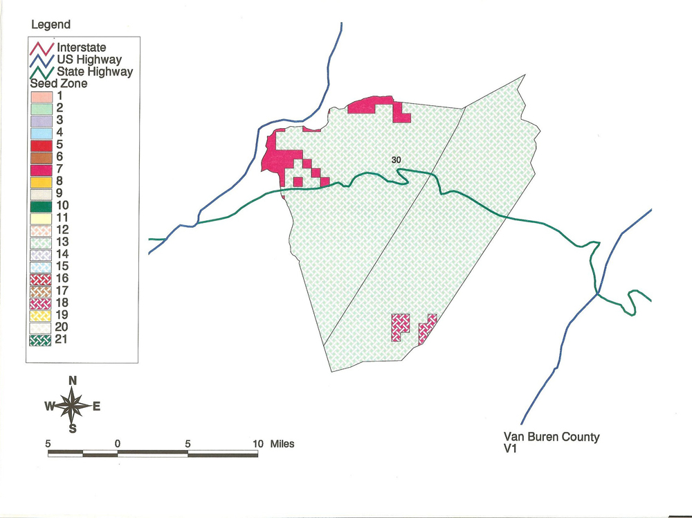
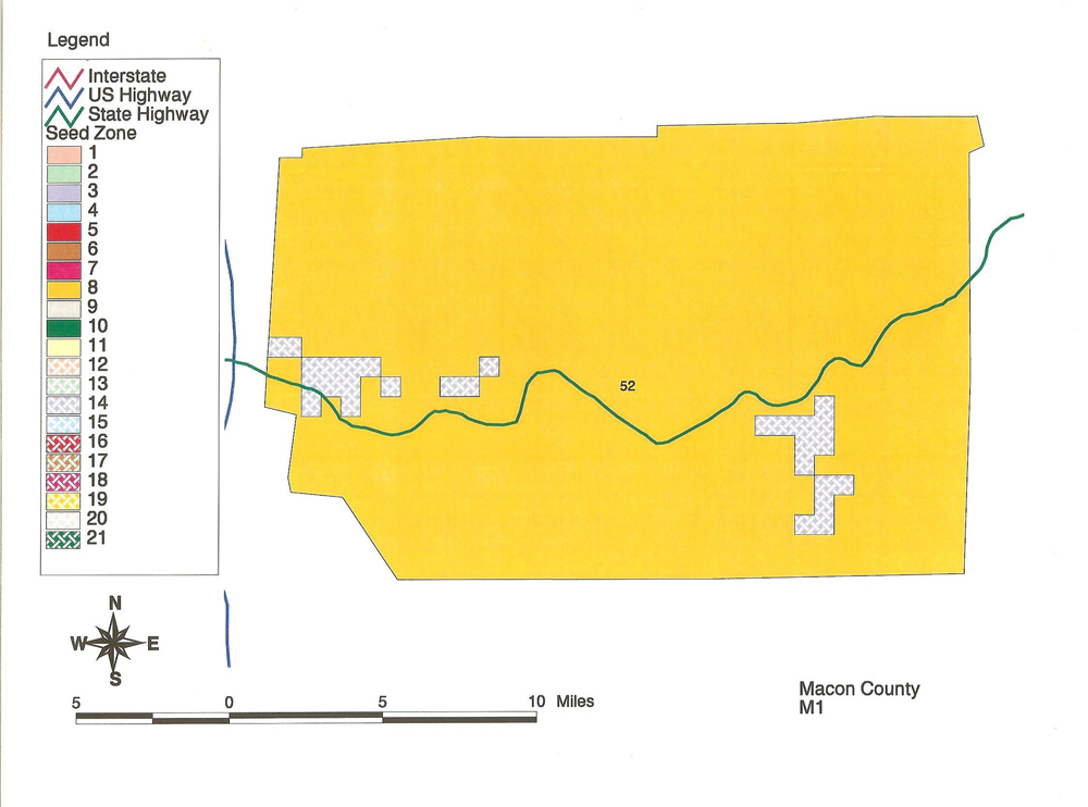
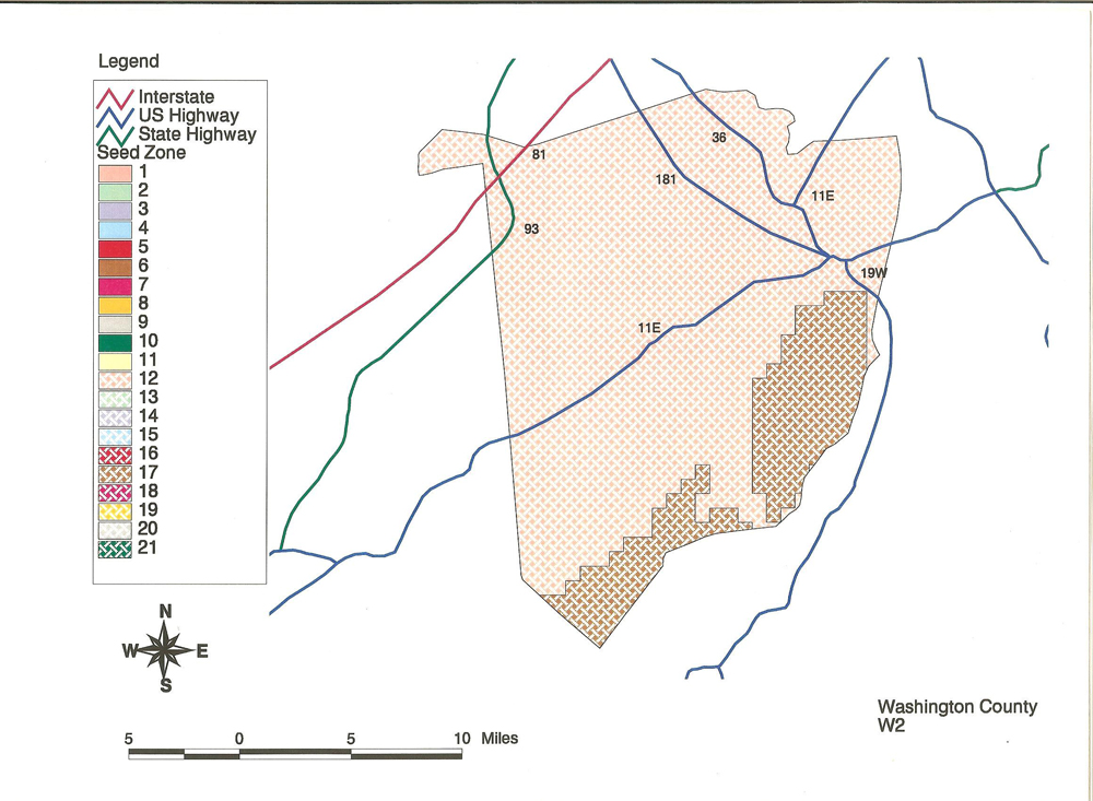
Samples of county level seed zone maps.